What Do You Actually See on an Arctic Circle Tour?
The Arctic Circle tour route from Fairbanks stop by stop: pipeline, Elliott and Dalton highways, Yukon River, Finger Mountain and the sign, and which tours stop where.
On an Arctic Circle tour from Fairbanks you see the Trans-Alaska Pipeline, the Elliott Highway through spruce hills, the start of the gravel Dalton Highway, the Yukon River at milepost 56, the tundra ridge of Finger Mountain at milepost 98 and the Arctic Circle sign at milepost 115, about 200 miles north of town. Most of the day is the road itself: 12 to 18 hours, mostly in a van, with stops every hour or two. Not every listing names every stop, so the table below shows which of the Arctic Circle tours from Fairbanks say where they stop.
Check Availability
Northern Lights & Arctic Circle Tour
- 4.6/5 (989 reviews)
- 12 to 14 hours
- Operated by Alaska Wild Lights
Includes Local driver-guide · Hotel pickup and drop-off within Fairbanks city limits · Personalized Arctic Circle certificate
You'll choose your date and complete the booking on Viator.
Same tour, also on GetYourGuide
From $363 per person · ★ 4.4 from 135 GetYourGuide reviews
Each platform sets its own price and collects its own reviews, so compare both before you book on Viator.
The route at a glance
Every ground tour follows the same road north. You leave Fairbanks on the Steese Highway to Fox, turn onto the Elliott Highway, join the Dalton Highway near Livengood, cross the Yukon River and climb into open country to the Arctic Circle Wayside. The BLM mileage chart puts the sign 199 road miles from Fairbanks, so the round trip runs roughly 400 miles.
| Stop | Location | Miles from Fairbanks | What you do |
|---|---|---|---|
| Trans-Alaska Pipeline | Steese Highway Mile 8.4, near Fox | about 8 | Walk up to the elevated pipe, read the displays |
| Elliott Highway | Fox to Elliott MP 73.1 | 11 to 84 | Paved drive through hills; some tours stop at Hilltop or Joy |
| Dalton Highway begins | Dalton MP 0, near Livengood | 84 | Pavement ends, gravel begins |
| Yukon River | Dalton MP 56 | 140 | Bridge, riverbank, Yukon River Camp meal stop |
| Finger Mountain | Dalton MP 98 | about 182 | Tundra walk, granite tors, wide views |
| Arctic Circle Wayside | Dalton MP 115 | 199 | Sign photos, viewing deck, certificate |
Under good conditions BLM puts the drive at about 3 hours to the Yukon River and 5 hours to the Arctic Circle, before stops. Guided tours add the stops, the return and, on aurora departures, late-night viewing. For the hours by tour, see how long the Arctic Circle tour is.
Stop 1: the Trans-Alaska Pipeline
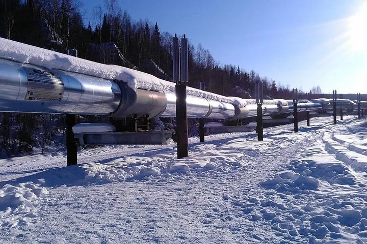
The first thing most tours show you is the pipeline. Alyeska’s viewing site at Steese Highway Mile 8.4, near Fox, has displays and parking, and you can walk right up to the raised pipe. The line runs 800 miles from Prudhoe Bay to Valdez, and the Dalton Highway parallels it all the way north, so you keep seeing it from the van. The Trans-Alaska Pipeline guide covers the engineering.
Other Experiences
Other experiences you might enjoy
Beyond the classic run up the Dalton Highway to the Yukon River, Finger Mountain and the Arctic Circle sign, Fairbanks has aurora tours and Chena Hot Springs trips too.
Stop 2: the Elliott Highway
From Fox the Elliott Highway climbs north for 73 miles, paved all the way to the Dalton junction. Two roadside stops appear in listings here: the Hilltop Truck Stop at Elliott Mile 5.5, known for its pie, and the Arctic Circle Trading Post in Joy at Mile 49.5, a homestead cabin with gifts and restrooms that Northern Alaska Tour Company uses as a regular stop and an aurora-viewing spot.
Stop 3: the Dalton Highway begins
At Elliott Mile 73.1, 84 miles from Fairbanks, the pavement ends and the Dalton Highway begins. BLM calls it a rough, industrial road, mostly gravel with paved stretches, built as the pipeline haul road in 1974. Big trucks have the right of way. Read more in the Dalton Highway from Fairbanks.
Stop 4: the Yukon River, milepost 56
At milepost 56 the road crosses the Yukon on the E. L. Patton Bridge, the only bridge over the Yukon in Alaska, with the pipeline running alongside. Yukon River Camp, just north of the bridge, is where most tours eat: several listings put lunch or dinner there, at your own cost. Our Yukon River guide has the details.
Stop 5: Finger Mountain, milepost 98
North of the Yukon the trees thin out. At Finger Mountain Wayside BLM has a half-mile interpretive trail across alpine tundra, granite tors and panoramic views, with strong winds on the ridge. See the Finger Mountain guide.
Stop 6: the Arctic Circle sign, milepost 115
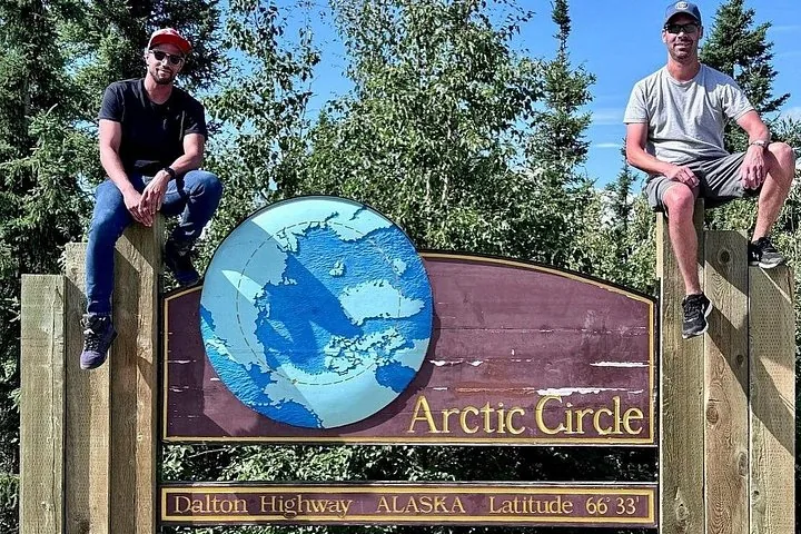
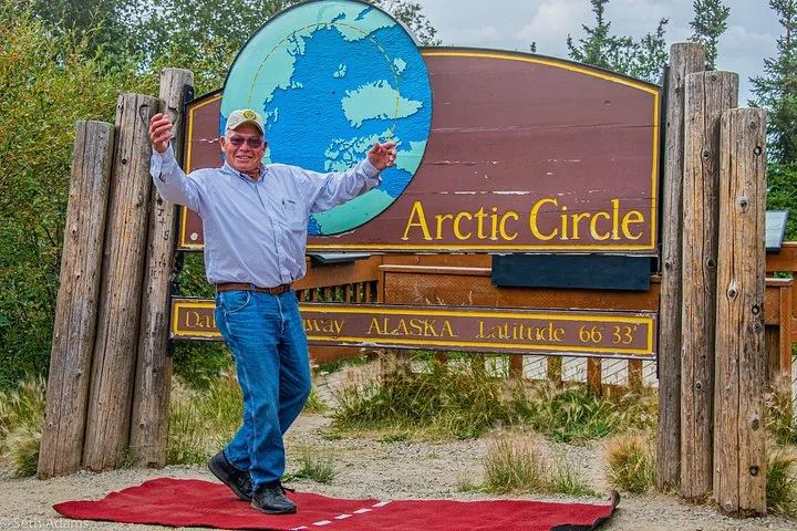
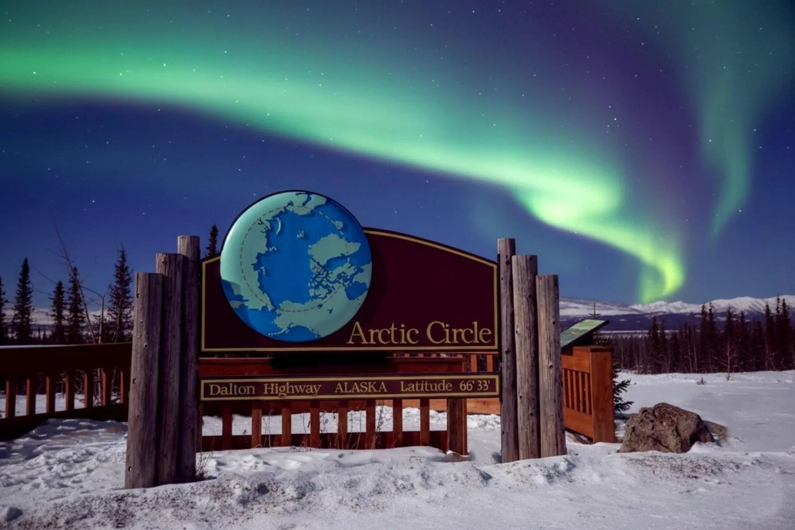
The turnaround is the BLM Arctic Circle Wayside: the sign at 66°33′ N, a wooden viewing deck with interpretive panels, picnic tables and pit toilets, with no cell service. Most tours on this site include a crossing certificate. The Arctic Circle sign guide explains what is there.
Which tours make which stops
This is what each listing on this site names. “Not listed” means the listing does not mention the stop, not that the van drives past it; the route passes every one of these places. Where the same trip’s other-network listing names a stop, the table says so.
| Tour | Pipeline | Yukon River | Finger Mountain | Arctic Circle | Other named stops |
|---|---|---|---|---|---|
| Northern Lights & Arctic Circle Tour | Yes | Yes (GYG listing) | Yes (GYG listing) | Yes | Aurora watch on return |
| Arctic Circle Day Tour | Yes (GYG listing) | Yes, Yukon River Camp lunch | Not listed | Yes | Tundra walk; Hilltop (GYG listing) |
| Original Arctic Circle Drive | Yes | Yes | Not listed | Yes | Arctic Circle Trading Post |
| Arctic Circle Winter Drive Adventure | Yes | Yes | Not listed | Yes | Tundra |
| Midnight Sun Arctic Circle Drive | Not listed | Not listed | Not listed | Yes | Not listed |
| Arctic Circle Aurora Drive Adventure | Yes | Yes | Not listed | Yes | Aurora watch in Joy |
| Arctic Circle Northern Lights Full-Day Trip | Yes | Yes | Yes | Yes | Aurora watch on return |
| Arctic Circle Adventure (summer) | Yes | Yes, twice | Yes, short hike | Yes | Restaurant stop |
| Arctic Circle Day Tour Adventure | Yes | Yes | Not listed | Yes | Not listed |
| Arctic Circle and Aurora Viewing | Not listed | Yes, 50-minute Yukon River Camp dinner break | Not listed | Yes | Aurora chasing, guide’s aurora photos |
| Arctic Circle with Aurora and Free Photos | Yes | Yes | Yes | Yes | Not listed |
| Arctic Circle & Northern Lights – Dalton Highway | Not listed | Yes, Yukon River Camp meal | Not listed | Yes | Grocery stop in Fairbanks |
If Finger Mountain matters to you, the tours that name it are the 1st Alaska Tours trips, Arctic Night Tours and, on its GetYourGuide listing, the Alaska Wild Lights aurora tour. The Arctic Circle Adventure runs in the summer season only.
Frequently asked questions
What is an Arctic Circle tour?
A guided trip from Fairbanks up the Elliott and Dalton highways to the Arctic Circle sign at milepost 115 and back, about 400 miles in a 12 to 18 hour day, with stops at the pipeline, the Yukon River and, on some tours, Finger Mountain.
How long is the drive from Fairbanks to the Arctic Circle?
BLM puts it at about 5 hours one way under good conditions, before stops. With stops and the return, tours run 12 to 18 hours.
Do all Arctic Circle tours stop at Finger Mountain?
No. Of the tours on this site, the 1st Alaska Tours trips and Arctic Night Tours name it, and so does the GetYourGuide listing of the Alaska Wild Lights aurora tour. Others do not list it.
Do Arctic Circle day tours go to Coldfoot?
The listings on this site name the Arctic Circle as the destination. Coldfoot is 60 miles farther north, 259 road miles from Fairbanks.
Where do you eat on an Arctic Circle tour?
Most tours stop at Yukon River Camp, and several listings exclude meals. The 1st Alaska Tours aurora trip includes sandwiches and hot drinks.
Ready to book?
Pick the tour that makes the stops you care about on the Arctic Circle day tours page, or go straight to live availability.
Cross the Arctic Circle This Season
The Dalton Highway by day, the 66°33′ sign by evening and an aurora watch on the drive back to Fairbanks.
Check Availability & Book