Finger Mountain, Alaska: What to Expect
Finger Mountain Wayside at Dalton Highway milepost 98: the granite tors, the half-mile tundra trail, the wind, the views and which Arctic Circle tours stop there.
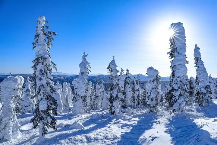
Finger Mountain is a BLM wayside on a high, windy ridge at Dalton Highway milepost 98, about 17 miles south of the Arctic Circle sign, where you walk a half-mile interpretive trail across alpine tundra among granite rock towers called tors. On a clear day the views run in every direction over open country, which is a big change after the spruce forest south of the Yukon River. Expect wind, a short walk and a pit-toilet stop. Several of the Arctic Circle tours from Fairbanks name it as a stop; others pass it without listing it.
Check Availability
Arctic Circle Day Tour Adventure
- 4.6/5 (81 reviews)
- About 12 hours
- Free cancellation
- Operated by Alaska Arctic Expeditions
Includes Local professional driver-guide · Hotel pickup in Fairbanks · Arctic Circle Certificate
You'll choose your date and complete the booking on Viator. Free cancellation up to 24 hours before departure.

Where Finger Mountain is
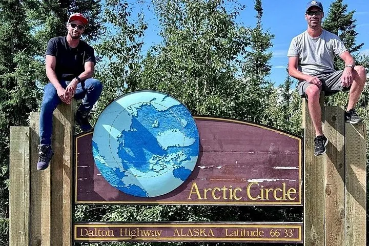
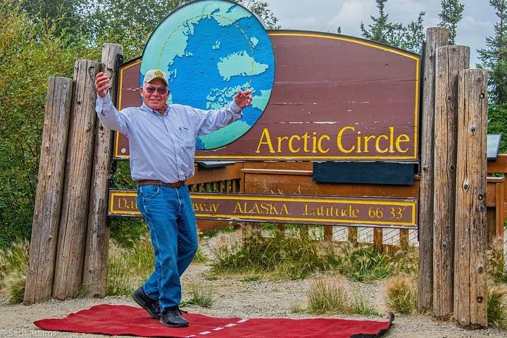
The wayside sits at Dalton Highway milepost 98 by BLM’s count (some guides print 97.5 or 98.1). That puts it 42 miles north of the Yukon River bridge at milepost 56 and 17 miles south of the Arctic Circle Wayside at milepost 115. From Fairbanks it is roughly 180 road miles: 84 miles to the start of the Dalton, then 98 more.
| Point on the route | Dalton milepost | Miles to Finger Mountain |
|---|---|---|
| Start of the Dalton Highway (near Livengood) | 0 | 98 |
| Yukon River and Yukon River Camp | 56 | 42 |
| 86-Mile Overlook | 86.5 | about 12 |
| Finger Mountain Wayside | 98 | 0 |
| Arctic Circle Wayside and sign | 115 | 17 |
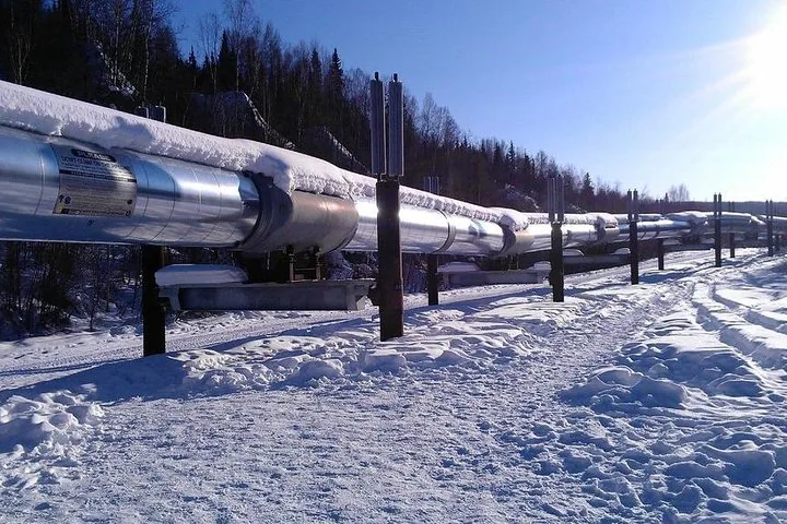
On a guided tour it is usually the last stop before the Arctic Circle on the way north, and a leg-stretch on the way back. The Arctic Circle tour itinerary puts it in sequence with the pipeline and the Yukon River.
What you see and do
BLM’s own description is short: take in the panoramic views, explore the alpine tundra and stroll the half-mile interpretive trail, and expect strong winds on this high ridge. Facilities are basic: a parking area, two pit toilets and interpretive signs.
The name comes from Finger Rock, a granite tor near the wayside. Tors are rock formations that stick up out of the ground, shaped by freezing and thawing. They give the ridge its odd skyline, and they are the photo most people take here.
The trail is the main event. Half a mile across tundra is an easy walk in summer, but it is uneven, often wet and fully exposed. The 1st Alaska Tours summer-season Arctic Circle Adventure – Full-Day Guided Tour describes a short scenic hike across a high plateau above the tree line. The Arctic Circle Northern Lights Full-Day Trip uses the plateau for a snack break and tells guests to watch for moose, foxes, bears and possibly lynx.
Other Experiences
Other experiences you might enjoy
Finger Mountain is one stop between the Yukon River and the Arctic Circle sign; Fairbanks also offers aurora tours, Dalton Highway trips and Chena Hot Springs visits.
Which tours stop at Finger Mountain
Not every listing names it. These are the tours on this site whose listings mention Finger Mountain:
- Arctic Circle Northern Lights Full-Day Trip (1st Alaska Tours)
- Arctic Circle Adventure – Full-Day Guided Tour (1st Alaska Tours, summer season)
- Arctic Circle with Aurora and Free Photos (Arctic Night Tours), which lists it among its photo stops
- Northern Lights & Arctic Circle Tour (Alaska Wild Lights), on its GetYourGuide listing
The Northern Alaska Tour Company drives and the Arctic Circle Day Tour Adventure describe tundra and scenic stops without naming Finger Mountain. Every ground tour to the sign drives past milepost 98, so if the stop matters to you, ask the operator before booking. Our review of the Arctic Circle Day Tour Adventure covers what that listing does name.
Weather and what to wear
The ridge is the most exposed stop of the day. BLM warns of strong winds there, and on the Dalton north of the Yukon winter lows commonly reach the −20s to −40s°F, with windchills to −70°F. Wind turns a short walk into real cold, so close every layer before you open the van door and wear boots with grip. In summer, bring a fleece and a wind shell even on a warm day in Fairbanks, plus repellent from mid-June into August. The what to wear guide has a season-by-season list.
The road on either side
The road climbs and drops over hills that truckers named: Mackey Hill at milepost 87 on the way up, and Beaver Slide at milepost 110 on the run down toward the Arctic Circle. Just before the wayside, the 86-Mile Overlook at milepost 86.5 has a short access road to a gravel-pit viewpoint over the Yukon Flats National Wildlife Refuge. North of the Yukon River, state law bars off-road vehicles within 5 miles of the highway, so stay on foot and on the trail.
Visiting on your own
You can drive to Finger Mountain yourself, but plan for it. The last fuel before the Dalton is at Fox and the Hilltop Truck Stop, and the next is Yukon River Camp at milepost 56. Cell coverage is very limited from Elliott Highway milepost 28 onward. BLM notes that many rental car agreements prohibit the Dalton and other gravel roads, and it advises independent drivers against travel between late October and early April. Our self-drive vs tour guide weighs the two.
Frequently asked questions
Where is Finger Mountain in Alaska?
On the Dalton Highway at milepost 98, a BLM wayside between the Yukon River (milepost 56) and the Arctic Circle sign (milepost 115), roughly 180 road miles north of Fairbanks.
How long is the Finger Mountain trail?
BLM lists a half-mile interpretive trail across alpine tundra at the wayside.
Why is it called Finger Mountain?
It is named for Finger Rock, a granite tor. Tors are rock outcrops shaped by freezing and thawing of the ground.
Which Arctic Circle tours stop at Finger Mountain?
On this site, the two 1st Alaska Tours trips and the Arctic Night Tours trip name it, and the Alaska Wild Lights aurora tour names it on its GetYourGuide listing.
Ready to book?
To make sure Finger Mountain is on your day, start with the Dalton Highway tours page or check live availability.
Cross the Arctic Circle This Season
The Dalton Highway by day, the 66°33′ sign by evening and an aurora watch on the drive back to Fairbanks.
Check Availability & Book