The Trans-Alaska Pipeline on an Arctic Circle Tour
Where to see the Trans-Alaska Pipeline near Fairbanks: the Fox viewpoint, why 420 of its 800 miles run above ground in a zigzag, and where Arctic Circle tours stop.
The easiest place to see the Trans-Alaska Pipeline near Fairbanks is the Alyeska viewing site at Steese Highway Mile 8.4, near Fox, where you can walk up to the raised pipe and read the information displays. On an Arctic Circle tour you see much more of it, because the Dalton Highway follows the pipeline north the whole way and the two cross the Yukon River on the same bridge. The line runs 800 miles from Prudhoe Bay to Valdez in a 48-inch pipe, and 420 of those miles sit above ground on supports in a deliberate zigzag. Most of the Arctic Circle tours from Fairbanks name a pipeline stop.
Check Availability
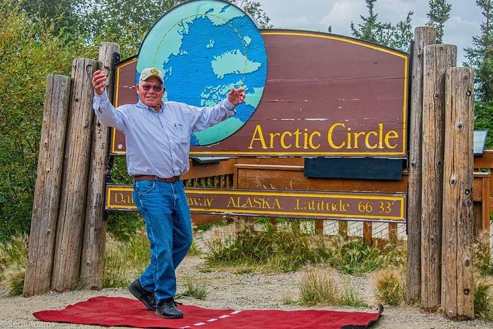
Original Arctic Circle Drive from Fairbanks
- 4.8/5 (226 reviews)
- About 16 hours
- Operated by Northern Alaska Tour Company
Includes Driver-guide with live commentary throughout the day · Official Arctic Circle Adventure Certificate · All taxes, fees …
You'll choose your date and complete the booking on Viator.
Where to see the pipeline near Fairbanks
The BLM’s Steese and Elliott highways brochure lists a pipeline viewing site at Steese Highway Mile 8.4, sponsored by the Alyeska Pipeline Service Company, with information displays and parking. It sits on the road north out of Fairbanks toward Fox, so it is on the way for any Arctic Circle trip and close enough to visit on its own if you have a car. You can walk right up to the elevated pipe and see the supports and the zigzag up close.
After that the pipe stays with you. The Dalton Highway was built in 1974 as the haul road for the pipeline, and it runs beside the line all the way to Prudhoe Bay. From the van you see it cross hills, drop out of sight underground and reappear. At the Yukon River the pipe crosses on the E. L. Patton Bridge next to the road. Alyeska pump stations along the route are closed to the public.
Pipeline facts in one table
| Fact | Figure |
|---|---|
| Length | 800 miles (1,288 km) |
| Route | Pump Station 1 at Prudhoe Bay to the Valdez Marine Terminal |
| Diameter | 48 inches |
| Above ground | 420 miles, on 78,000 vertical support members |
| Buried | 380 miles |
| Construction of the pipe | 27 March 1975 to 31 May 1977 |
| First oil | 20 June 1977 |
| Cost | about $8 billion in 1977 dollars |
| Mountain ranges crossed | Three: Brooks, Alaska and Chugach |
| Highest point | Atigun Pass, 4,739 feet |
| Oil moved since 1977 | More than 18 billion barrels |
The whole project, haul road included, ran from 1974 to 1977, but the pipe itself went in between 1975 and 1977. At the time it was the largest privately funded construction project, and about 70,000 people worked on it between 1969 and 1977.
Other Experiences
Other experiences you might enjoy
The pipeline is the first stop of the day; Fairbanks also has aurora tours, Dalton Highway trips to the Yukon River and Finger Mountain, and Chena Hot Springs outings.
Why so much of it is above ground
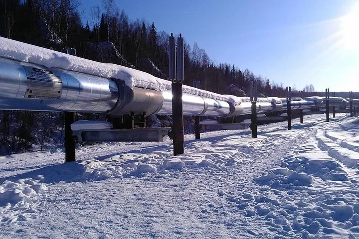
Oil leaves Prudhoe Bay warm. Buried in permafrost, a warm pipe would thaw the frozen ground around it and lose its support. So across much of the route the pipe rides above the ground on vertical supports, 420 of its 800 miles in all. More than 124,000 heat pipes on those supports carry ground heat up and away, keeping the permafrost frozen. The other 380 miles are buried, which is why you see it vanish and reappear from the Dalton.
Why it zigzags
The pipe grows and shrinks as its temperature changes. Laid in a straight line, that lengthwise movement would have nowhere to go. Laid in a zigzag, it turns into sideways movement on the supports, which slide to absorb it. Near the Denali Fault, the zigzags are wider still, and the supports there can take up to 20 feet of sideways and 5 feet of vertical movement in an earthquake. Standing at the Fox viewing site, you can see the bends for yourself.
Watching for it from the Dalton
Once you are on the Dalton, ask your guide to point out the river crossings. The pipeline crosses 34 major rivers and streams and about 500 minor ones, and it crosses the Yukon at pipeline milepost 353.3 on one of its 13 river bridges, the same one your van drives over. Eleven pump stations were built along the line, and none is open to visitors. North of the Arctic Circle the pipe climbs to its highest point at Atigun Pass, well beyond where day tours turn around. The Yukon River guide covers the shared bridge.
Where Arctic Circle tours stop
Listings rarely say which pullout they use, but most of them name the pipeline:
| Tour | What the listing says |
|---|---|
| Original Arctic Circle Drive | “View the remarkable Trans Alaska Pipeline” |
| Arctic Circle Winter Drive Adventure | “View the remarkable Trans Alaska Pipeline” |
| Arctic Circle Adventure – Full-Day Guided Tour | Pipeline photo stop and visit with the guide (summer season) |
| Arctic Circle Northern Lights Full-Day Trip | Stop at the pipeline to learn about its engineering |
| Northern Lights & Arctic Circle Tour | Learn about the pipeline with the guide |
| Arctic Circle Day Tour Adventure | Views of the pipeline |
| Arctic Circle with Aurora and Free Photos | Pipeline among the photo stops |
The Northern Alaska Tour Company drives start from the company’s office at the Fairbanks airport, and the Original Arctic Circle Drive has a check-in that closes at 6:00 a.m. Read our review of the Original Arctic Circle Drive for the rest of that day, and the Arctic Circle tour itinerary for every stop on every tour.
Frequently asked questions
Where can I see the Alaska pipeline near Fairbanks?
At the Alyeska pipeline viewing site at Steese Highway Mile 8.4, near Fox, which has displays and parking. You can walk up to the elevated pipe there.
How long is the Trans-Alaska Pipeline?
800 miles, from Prudhoe Bay to the Valdez Marine Terminal, in a 48-inch pipe.
When was the Trans-Alaska Pipeline built?
The pipe was laid from 27 March 1975 to 31 May 1977, and the first oil moved on 20 June 1977. The haul road that became the Dalton Highway was built in 1974.
Why is the pipeline above ground?
Warm oil would thaw the permafrost around a buried pipe, so 420 of the 800 miles run on supports above the ground, with heat pipes keeping the ground frozen.
Do Arctic Circle tours stop at the pipeline?
Most do. Most listings on this site name the pipeline, and the Dalton Highway runs beside it all the way to the Arctic Circle.
Ready to book?
The pipeline comes with every drive north. Compare the options on the Dalton Highway tours page or go straight to live availability.
Cross the Arctic Circle This Season
The Dalton Highway by day, the 66°33′ sign by evening and an aurora watch on the drive back to Fairbanks.
Check Availability & Book